
Create maps from multiple input types
Paste text, upload images, enter URLs, or use CSV files and AI-style prompts to generate maps from the locations Textomap finds in the content.

Textomap creates interactive maps from text, images, URLs, CSV files, and AI prompts, helping you turn location-rich content into shareable, embeddable maps with less manual work.
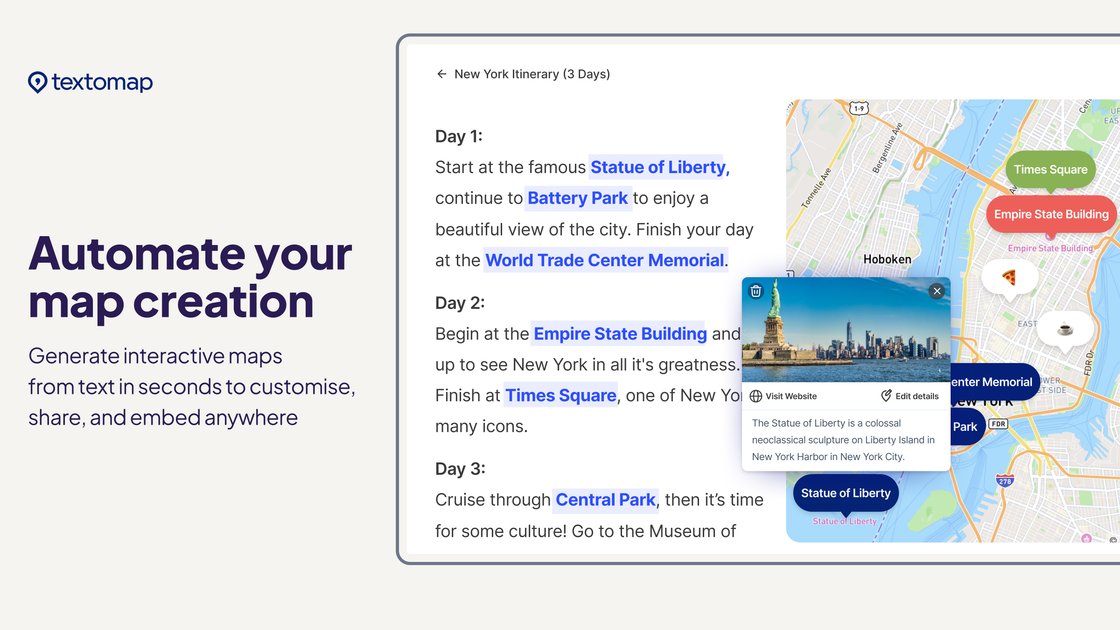
Textomap is a map-generation tool that turns text, images, URLs, CSV files, and AI prompts into interactive maps. Its core job is to extract locations from source content and present them on a map that can be shared, embedded, or exported.
The product is aimed at people who work with location-rich content, including educators, content creators, travel teams, and news or documentation workflows. The site also highlights browser and WordPress extensions, so maps can be created from webpages and embedded into WordPress with less manual setup.
Paste text, upload images, enter URLs, or use CSV files and AI-style prompts to generate maps from the locations Textomap finds in the content.
Textomap automatically detects locations, which reduces manual pinning and avoids starting from spreadsheets for every map.
Create and view maps in the same tab while browsing websites, social media, docs, or email, using the Chrome extension.
Create maps for WordPress sites and embed them into posts, with maps generated and customized before publishing.
Share maps through link or social media, export them to Google Maps, and import or export CSV data.
Use the product in 28+ languages, with the FAQ and page copy indicating support for multiple languages across content and prompts.
Turn articles, itineraries, emails, class material, or news posts into maps that help readers see where places are mentioned and how they relate geographically.
Use the product to create classroom maps from prompts, questions, or reading material so students can explore geography, history, and science topics visually.
Scan webpages, social posts, or documents while browsing and generate a map in the same tab, which is useful for research and trip planning.
Upload CSV files containing addresses, cities, or coordinates to create a map from structured location data.
Embed an interactive map in a WordPress post or page after customizing it, then share or update it alongside the surrounding content.
Textomap can create interactive maps from text, images, URLs, CSV files, and AI or ChatGPT-style prompts. It is designed for turning location-rich content into maps that can be shared or embedded.
Textomap automatically detects locations from content, so you do not need to pin locations manually or start from a spreadsheet. It also works on desktop, mobile, and through a Chrome extension.
You can upload an image that contains location data or landmarks, and Textomap uses AI to identify the locations and plot them on a map.
Yes. You can paste a URL and Textomap will extract locations mentioned on the page and generate a map.
Yes. Textomap offers a free plan, and the pricing page lists paid plans with additional features, higher limits, and ad-free use. Billing is processed through Stripe, and PayPal is also supported at checkout.