
Photo geolocation
GeoSpy uses AI location models to estimate where a photo was taken, with the homepage describing meter-level accuracy for qualified enterprise and government users.

GeoSpy is an AI image geolocation platform from Graylark Technologies for law enforcement, government, and enterprise teams. Pricing and licensing available on request.
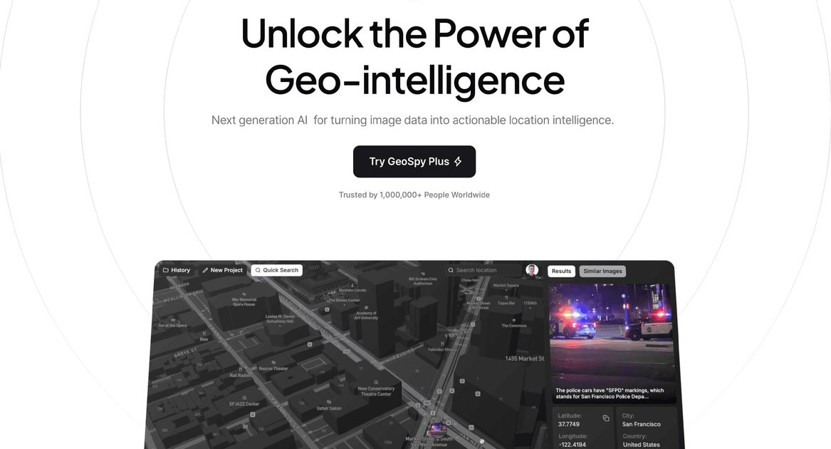
GeoSpy is an AI-powered image geolocation platform from Graylark Technologies. It is positioned for enterprise and law enforcement teams that need to identify where a photo was taken by analyzing visual content rather than relying on embedded metadata.
The homepage describes GeoSpy as a visual intelligence platform that can turn low-context photos into location intelligence and says it can deliver meter-level accuracy for qualified government and enterprise organizations. The terms of service also describe it as a paid service, with access that may begin with a trial period and then continue under a subscription or service agreement.
The product site frames GeoSpy as a tool for investigations, fraud review, media verification, and other workflows where a fast location estimate is useful. The company also states that access is controlled and that usage is intended for approved organizations.
GeoSpy uses AI location models to estimate where a photo was taken, with the homepage describing meter-level accuracy for qualified enterprise and government users.
The product says it can work without image metadata, using the pixels and visual context in the image instead of relying on embedded location data.
The homepage frames GeoSpy as a low-context image tool for turning sparse photos into location intelligence, which is useful when a scene has limited identifying information.
The site presents a web interface for reviewing results, and the terms also state that the service can be used through a mobile application or API.
The blog describes GeoSpy as a large geospatial model that interprets visual data spatially, including images, scans, photogrammetric data, and volumetric 3D data.
The terms and blog emphasize controlled access, auditability, and human oversight for responsible use of the service.
Investigators can upload a photo from a case and use GeoSpy to infer where it was taken when there are only a few visible landmarks or contextual clues.
Government and enterprise teams can review images tied to incidents, claims, or internal cases to speed up location verification and triage.
The blog describes GeoSpy as useful for checking whether a reported claim location matches visual details such as road texture, foliage, and solar angles.
Newsrooms and verification teams can use the product to help confirm where a clip or image originated before publishing or amplifying it.
The site’s examples also include delivery workflows, where a proof-of-delivery photo can be checked against the intended address or property context.
GeoSpy is accessed through a web interface, and its terms also say it can be used via a mobile application or programmatically through an API. The site indicates that access and enrollment details may vary by service agreement.
The source does not publish a self-serve pricing table. The homepage and terms indicate that licensing and pricing are available upon request, and that access may begin with a trial period subject to review and approval.
GeoSpy is described as a paid AI-powered geolocation service. The terms say continued use after any trial period requires payment according to the subscription or service agreement provided at the time of enrollment.
GeoSpy is designed to work from uploaded images and associated metadata, with the homepage emphasizing that it does not require metadata to generate location predictions. The product focuses on extracting location intelligence from pixels and visual context.
The source materials emphasize controlled access, auditability, and human oversight. They also state that anonymous access and passive mass monitoring are not allowed.