
Large curated place map
Browse a single world map that contains 71,763 notable places across 349 countries, covering categories from ruins and castles to beaches and ghost towns.

Detourmap is a free interactive world map of notable places, organized by country, category, and fame tier, with pins linked to photos and Wikipedia.
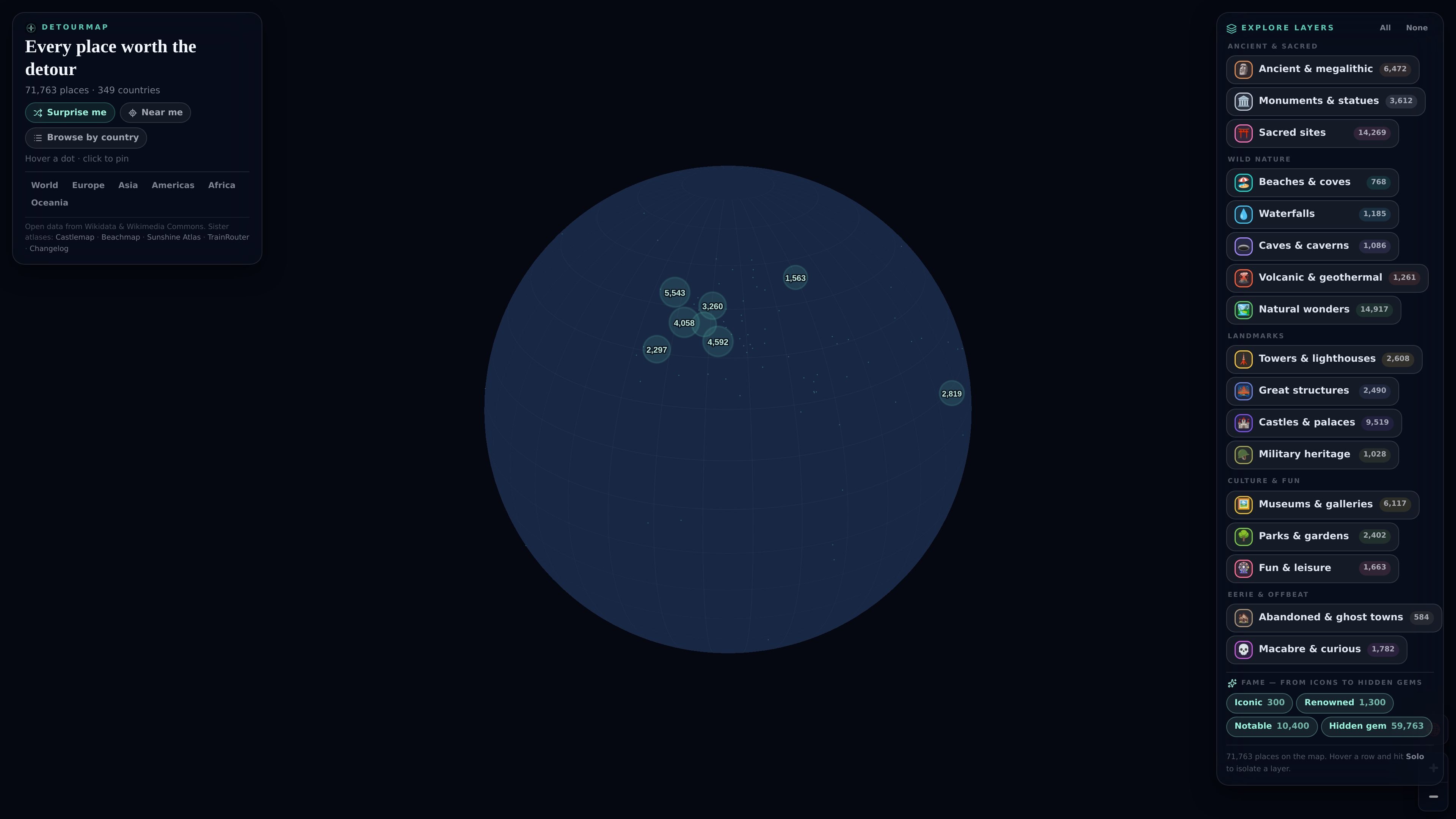
Detourmap is a free interactive world map of notable places built from open data. It brings together 71,763 locations across 349 countries, from ancient ruins and castles to beaches, caves, waterfalls, museums, and ghost towns.
The product is designed for browsing places worth a detour rather than only headline landmarks. Users can start from a country, open a layer page, filter out famous tiers, or use surprise-me and nearby-location tools to find lesser-known sites. Each place on the map has a photo and a Wikipedia article behind it, and the site requires JavaScript and WebGL for the interactive map.
Browse a single world map that contains 71,763 notable places across 349 countries, covering categories from ruins and castles to beaches and ghost towns.
Open the map from country pages or from layer pages. The site says every layer has its own page, and every country with eight or more places also gets a page.
Filter by fame tier. Places are labeled Iconic, Renowned, Notable, or Hidden gem, which makes it easier to focus on lesser-known locations.
Each pin includes a photo and a linked Wikipedia article, giving readers a quick way to check what a place is and move to the underlying source.
Use the “Surprise me” control or the nearby location tool to discover places at random or within a 25, 50, 100, or 200 km radius.
The site states that the full dataset is downloadable as CSV and GeoJSON, and that AI assistants can query it through an MCP server.
Use the country index to see what is in a specific place, then jump from the country page to individual pins or layer pages for a more focused browse.
Turn off the famous tiers and scan for the long tail of ruins, caves, ghost towns, and other lesser-known places when you want alternatives to standard tourist lists.
Use the “Surprise me” control or nearby-location mode when you want the site to suggest places without already knowing what to search for.
Open a layer such as ancient sites, castles, waterfalls, or museums when you want a themed list rather than a general map.
Download CSV or GeoJSON, or query the dataset through the MCP server, if you need to reuse the place records outside the map interface.
Detourmap is a free interactive world map of notable places. It organizes 71,763 places across 349 countries and lets you browse them by kind or by country, with each place linked to a photo and a Wikipedia article.
Yes. The site states that it is free, with no account and no ads.
Detourmap uses a fame tier system with four labels: Iconic, Renowned, Notable, and Hidden gem. You can switch off the famous tiers so the less obvious places remain, and the “Surprise me” control tends to surface little-known places more often.
Detourmap says the map is built from Wikidata place records and Wikimedia Commons photos. A place appears only if it has coordinates, a photo, and an English Wikipedia article.
Detourmap needs JavaScript and WebGL to run the interactive map. The site also says the full dataset is downloadable as CSV and GeoJSON, and that AI assistants can query it through an MCP server.